Georadar can be used to:
- Detect underground utilities such as pipes, cables, and ducts before excavation or foundation installation
- Identify voids or anomalies beneath the ground, road pavement, or floors
- Map shallow soil and rock layers
- Check road pavement thickness and the condition of the underlying layers
- Scan concrete elements, for example the position of reinforcement within slabs or walls
- Locate buried structures, such as old foundations or underground tanks
Please note that the depth of penetration and clarity of georadar results are affected by soil conditions. Wet clay, for example, can attenuate the signal and reduce the depth of penetration. That is why we assess site conditions from the outset and explain the limitations of the results to you honestly. When needed, georadar results can be confirmed with other methods such as test pits or drilling.
Scope of Work & Work Stages
- Consultation & Objective SettingWe clarify what needs to be found (utilities, voids, layers, or structural conditions), the required depth, and the site conditions.
- Site Survey & Survey Line LayoutSurvey lines are planned in a suitable pattern, such as straight lines or a grid, and then marked on the surface.
- Equipment CalibrationThe equipment is prepared and configured to suit the soil conditions and target depth.
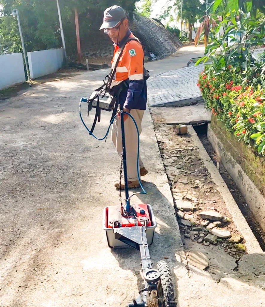
- Field Data AcquisitionThe instrument is moved along the survey lines to continuously record wave reflections.
- Data ProcessingRecordings are processed to sharpen the subsurface image and reduce noise.
- InterpretationEngineers interpret the results to identify objects, voids, layers, or anomalies, along with their estimated position and depth.
- Validation (if required)Key points can be confirmed with other methods such as test excavations or drilling.
- ReportingResults are presented in a report and a map of finding locations.
What You Get
- Radar cross-section recordings (radargrams) for each survey line
- Subsurface interpretation: location and depth of utilities, voids, or anomalies
- Map of finding locations on the survey area plan
- Explanation of result limitations based on site soil conditions
- Follow-up recommendations, such as additional validation or adjustments to the work plan
- Georadar survey report
Integrated with Other CRN Services
PT Cipta Reka Nusantara handles surveys, design, engineering, and permitting within a single team. Data from this service is used directly in subsequent work, so there is no need for re-measurement and every project stage uses the same reference.
- Before drilling and excavation: detecting underground utilities (pipes, cables, ducts) makes Deep Boring (Boring & SPT) and Sondir (CPT) safer.
- Result validation: georadar findings can be confirmed with test pits or drilling through our Soil Investigation Survey.
- Concrete element inspection: scanning slabs and walls complements Rebar Scan and Concrete Coring (Core Drill) within our Investigation Survey.
- Foundation and renovation planning: the location of buried structures such as old foundations provides input for Detail Engineering Design (DED) and Factory & Warehouse Structural Audit.