
However good a building's design, its strength depends on the soil that supports it. A soil investigation survey is carried out to understand ground conditions before the foundation is designed. This article explains its purpose, the methods commonly used, and the data you receive.
What is a soil investigation survey?
A soil investigation survey is a series of tests to determine the soil layers (stratigraphy), soil stiffness and bearing capacity, and groundwater level at the project site. The results form the basis for designing the foundation and the building's substructure.
Why is a soil survey important before building?
Soil differs from site to site, even on neighboring plots. Without accurate soil data, designers are only guessing, and a wrong guess can result in:
- Building settlement that is uneven, causing walls and floors to crack
- Inadequate foundations that compromise the building's safety
- Over-designed foundations that inflate construction costs unnecessarily
- Problems during excavation, such as a high groundwater level or unexpected soft layers
The cost of soil investigation is generally small compared to construction costs, but its impact on safety and efficiency is significant.
Commonly used methods
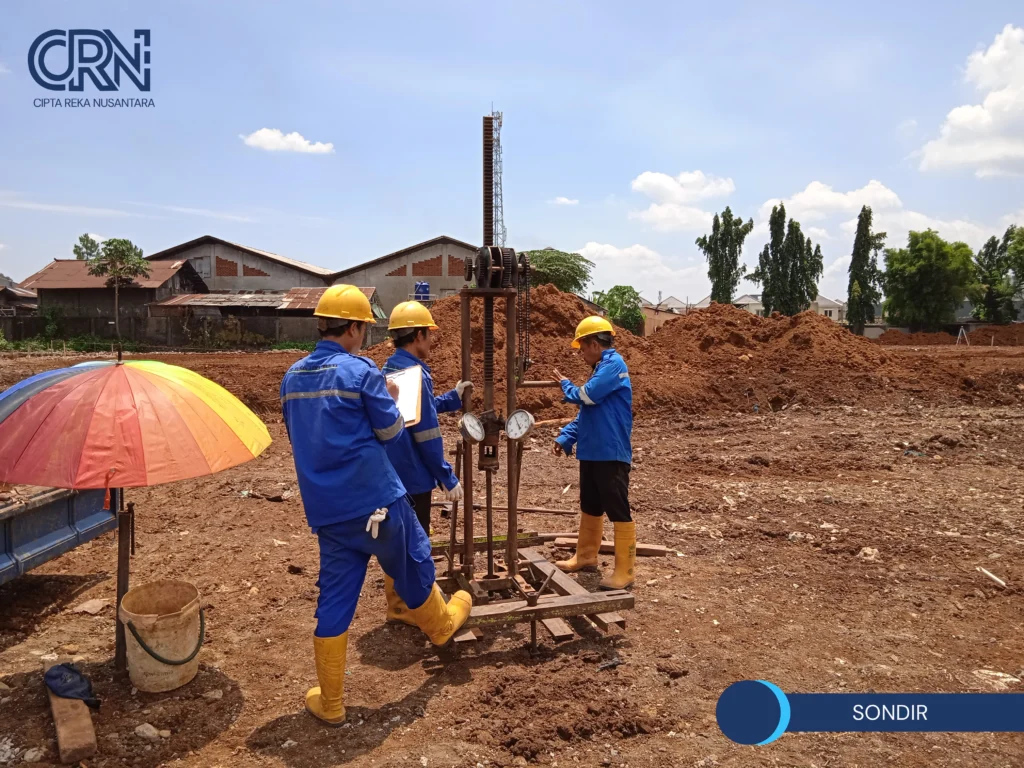
Sondir (Cone Penetration Test). A steel cone is pushed into the ground in stages while measuring the soil's resistance. The result is a profile of soil stiffness against depth and an estimate of bearing capacity. The Cone Penetration Test (CPT, locally called sondir) is suitable for soft to medium soils and is relatively quick to carry out.
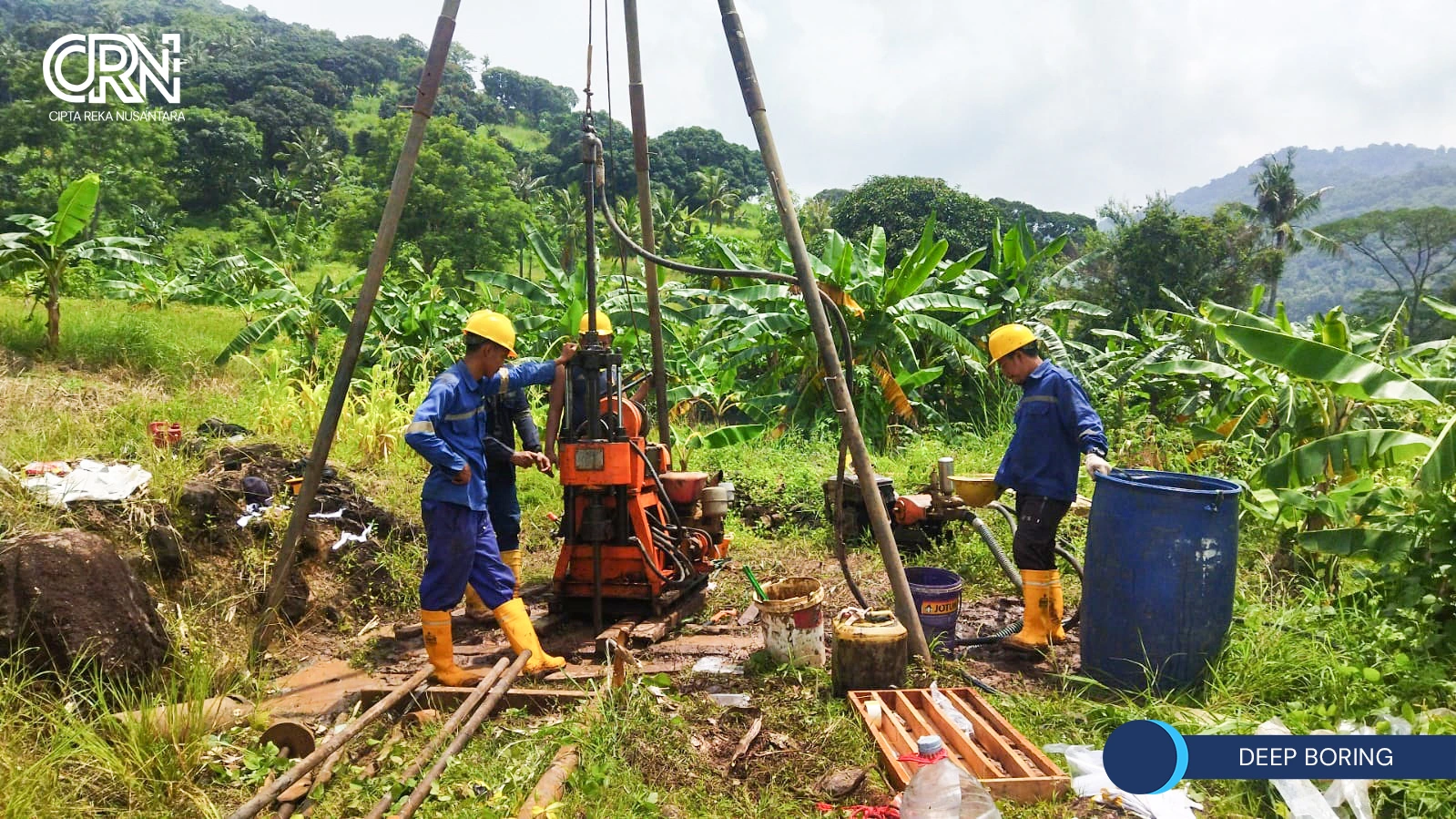
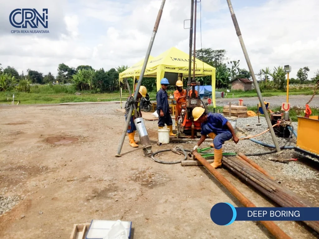
Deep boring and SPT (Standard Penetration Test). Boring reaches greater depths and can penetrate harder layers. At set intervals, an SPT is performed to obtain the N-value, which reflects the density or consistency of the soil. Boring also produces a boring log, groundwater information, and soil samples.
Soil mechanics laboratory testing. Samples from boring are tested to determine soil properties in more detail, including moisture content, unit weight, Atterberg limits, grain size distribution, shear strength (triaxial, UCS, or direct shear), and consolidation to estimate settlement.
Many projects combine several methods to obtain a more complete picture of the soil. The choice of method depends on the type of building, design loads, and soil conditions.
What data do you get?
- Soil profile and layer arrangement by depth
- Depth of the hard soil layer
- Cone resistance values (CPT) and N-SPT values
- Groundwater level depth
- Laboratory soil parameters for bearing capacity and settlement calculations
- Recommendations for foundation type and depth
When should a soil survey be carried out?
Ideally before the foundation and structural design is finalized, that is, in the early planning stage. A soil survey is also needed when planning additional floors, inspecting a building that has settled, or preparing supporting data for a PBG application.
Common mistakes
- Skipping the soil survey on small buildings because it is considered unnecessary
- Too few test points so they do not represent the soil variation across the site
- Using data from a neighboring plot which may not match the conditions on your site
- Surveying too late, after the foundation design is complete, so the design must be redone
[Add one real case example from a Cipta Reka project: the soil conditions found and their effect on the foundation design. Anonymize the client's identity if necessary.]
Frequently asked questions
- Does a single-story house need a soil survey? It depends on the site conditions and foundation type. On soft soil or land with an unknown history, a survey is still recommended even for a small building. An engineer can recommend a suitable program.
- Which is better, CPT or boring? Each has its own uses, and they often complement each other. CPT is fast for profiling the stiffness of soft to medium soils, while boring goes deeper, produces samples, and can penetrate hard layers.
- How long does a soil survey take? It depends on the number of points, depth, and site access. Laboratory testing also requires its own time. An estimated timeline can be provided once the scope of work is clear.
- Can soil survey results be used for another project? Not recommended. Soil data applies only to its location and test points.
Plan your building's foundation with the right data
PT Cipta Reka Nusantara provides soil investigation surveys (CPT and deep boring) and soil mechanics laboratory testing, integrated with design and DED. Contact us to plan the soil investigation for your project.